
Data Point related to: ELEMENT
Gwanghwamun Plaza - 광화문광장
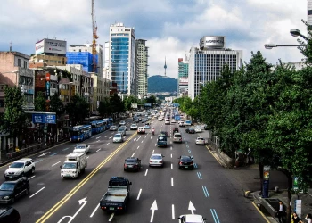
Gwanghwamun Plaza (Korean: 광화문광장; also known as Gwanghwamun Square) is a public open space on Sejongno, Jongno-gu, Seoul, South Korea. The plaza was opened on 1 August 2009 by the Seoul Metropolitan Government and is part of the City's plans for environmentally friendly renovation projects such as the Cheonggye Stream and Seoul Plaza. It is also historically significant as the location of royal administrative buildings, known as Yukjo-geori or Street of Six Ministries; and features statues of Admiral Yi Sun-sin of Joseon Dynasty and King Sejong the Great of Joseon. The goal of opening and reconstructing this plaza is to make it a historical and cultural place for the common citizen. The area of the Gwanghwamun Plaza has a long history. It has been a public space and road for centuries of Korean history. Sometime in the 20th century it was converted into a 16-lane roadway. Construction of the plaza was originally scheduled to begin in February 2008, however it was delayed because of opposition from the National Police Agency, who were concerned that the plaza could be abused as a venue for mass protests. Construction commenced on 23 April 2008, after the Government decreed it a demonstration-free zone. The plaza was opened on 1 August 2009 after a renovation period of 15 months, which downsized the 600-meter Sejongno from 16 lanes to 10 lanes of traffic, at a cost of ₩44.5 billion. From end of 2020 to August 2022, Gwanghwamun Plaza was closed and redesigned. During the renovation, the street alignment has been changed and the plaza has been expanded. It was reopened on 6 August 2022.
Type of Data Point - Basic Data Point - Source Wikipedia
Visit page of the element - Gwanghwamun Plaza - 광화문광장
Inserted: 16-01-2023 07:01:23
Questions related to this Data Point
 What is an alternative name for Gwanghwamun Plaza in Seoul?
What is the history of the interventions on the Gwanghwamun Plaza in Seoul?
What was the goal of opening the Gwanghwamun Plaza in Seoul?
When was the Gwanghwamun Plaza in Seoul converted into a 16-lane roadway?
When was the Gwanghwamun Plaza in Seoul last reopened?
When was the Gwanghwamun Plaza opened?
Who opposed the construction of the Gwanghwamun Plaza in Seoul?
Contexts related to this Data Point
 Streets in the city of Seoul
Walking area in the city


Entities related to this Data Point
No Entities found
Words related to this Data Point

Dates/Years/Periods related to this Data Point
Image Gallery
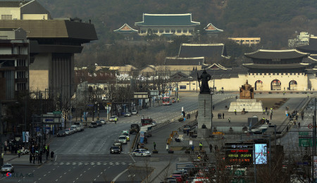
Credits: Korea.net / Korean Culture and Information Service (Photographer name), CC BY-SA 2.0, via Wikimedia
Other Data Points
Hyoksin Station (Korean: 혁신역) is a station located on the Hyŏksin Line of the Pyongyang Metro in North Korea. This station is conveniently positioned across the street from a park and is ...

The Cathedral of St. John the Baptist stands as the defining symbol of Comrat. Initially constructed through contributions from Comrat's residents, the cathedral served as a focal point for ...

Data point related to the Palace of the Royal Judicial Table - Osijek Municipal Court located in Osijek. This element is categorized as Architecture,Building,Government Building,Historical B ...

In Vlora there is the Clock Tower of Vlora, Architecture,Historical Building,Tower. The coordinates of Clock Tower of Vlora are 40.4730 (North), 19.4908 (East). To help you have a better ide ...

Vilanija, part of Umag in Istria County within the Republic of Croatia, is a village witnessing a population increase. The 2001 census recorded 178 inhabitants and 58 family households. By 2 ...
Articles
View All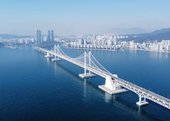
Gwangan Bridge - Busan - Glabb, CC BY-SA 3.0, via Wikimedia Commons
Infrastructures in South Korea
January 5th, 2024
Explore South Korea's vital infrastructures on our interactive map. From transportation to energy, delve into the nation's innovation and connectivity.
Tristan Surtel, CC BY-SA 4.0, via Wikimedia Commons
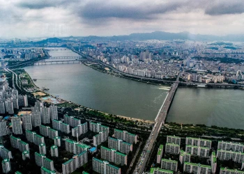
Along the Han River in Seoul
October 28th, 2023
The Han River, or 'Hangang' in Korean, symbolizes Seoul's history and daily life. Flowing through the city, it has witnessed millennia of events. From serene parks to lively light displays, it's a must-visit.
English: IGEL, CC BY-SA 3.0, via Wikimedia Commons
Streets in the city of Seoul
October 19th, 2023
Take a virtual stroll through Seoul's vibrant streets, exploring the historical arteries of Jongno and Myeong-dong Walking Street, as well as the modern pulse of Namdaemun-ro and Teheran-ro—all intricately mapped and curated for a personalized exploration of the city's diverse landscape.


