
Published Jan 05, 2024 - Updated Apr 22, 2024
Within South Korea, infrastructures stand as the fundamental backbone knitting together progress and connectivity, painting a vivid canvas of innovation across the nation's dynamic landscape. As we delve into our exploration, we'll unveil these infrastructures, beautifully showcased and navigable through an interactive map interface.
This article delves into the intricate web of transportation, energy, and communication networks that define South Korea's landscape. Embracing the power of community, it spotlights a collaborative map inviting historical anecdotes, technical insights, and captivating visuals to enrich our understanding of these vital structures.
What is considered an Infrastructure
Infrastructure is the lifeblood of societal advancement, comprising the physical and organizational frameworks that facilitate a nation's functionality and development. It encompasses a diverse spectrum, spanning transportation systems like roads, railways, and ports, to utilities such as water supply, energy grids, and telecommunications networks. Beyond tangible assets, it includes institutions, policies, and socio-economic structures crucial for sustained growth and quality of life. In South Korea, infrastructure embodies the fusion of modernity and tradition, propelling the nation into a global hub of technological innovation and connectivity.
Brief History of Infrastructure Development in South Korea
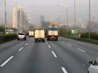
South Korea's remarkable ascent from post-war devastation to a global economic powerhouse is intricately woven into its infrastructure narrative. In the 1950s, after the Korean War, the nation faced immense challenges in rebuilding. However, visionary leadership and strategic investments propelled a rapid transformation. The 1960s saw a surge in infrastructure development, with a focus on road networks and bridges to connect cities and rural areas, laying the groundwork for industrial growth.
The 1970s marked a pivotal shift as South Korea prioritized heavy industries and exports, triggering an infrastructure overhaul. Ambitious projects like the Gyeongbu Expressway, connecting Seoul to Busan, exemplified this drive. Simultaneously, ports like Busan emerged as key trade gateways, fostering international connectivity.
By the 1980s, South Korea's infrastructure landscape was evolving rapidly. Investments surged in telecommunications, culminating in a digital revolution. The country embraced high-speed internet, laying the groundwork for technological advancements that would redefine global connectivity.
The 21st century heralded a new era of innovation and sustainability. South Korea emerged as a leader in green infrastructure, investing in renewable energy sources and eco-friendly transportation. Landmark projects like the Incheon International Airport and the Seoul High-Speed Railway stand as testaments to the nation's engineering prowess and forward-thinking approach.
Today, South Korea's infrastructure narrative continues to evolve. Smart cities like Songdo showcase cutting-edge technologies, integrating data-driven solutions for efficient living. The government's emphasis on innovation and sustainability drives ongoing initiatives, positioning South Korea at the forefront of global infrastructure development.
The collaborative map initiative aims to celebrate this rich heritage, inviting individuals to contribute personal anecdotes, historical insights, technical data, and captivating visuals. Together, we can create a living archive, honoring the legacy of South Korea's infrastructural marvels and shaping a more comprehensive understanding of their societal impact.
Exploring Select Infrastructures in South Korea
Ttukseom Park Metro Station - 뚝섬유원지역
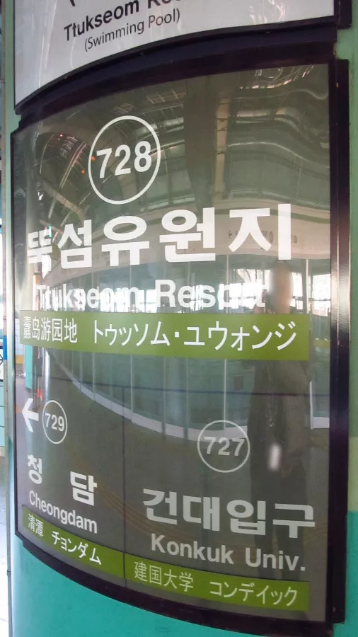
Ttukseom Park Station, known as 뚝섬유원지역 in Korean, is a stop on Seoul Subway Line 7. Situated in Noyu-dong within the Gwangjin-gu administrative district of Seoul, it holds a unique distinction as the sole station in South Korea nestled beneath a bridge, specifically under Cheongdam Bridge - 청담대교. Additionally, the station runs below a highway and boasts two exits on the south and two on the (Read More)
Guseo Station - 구서역
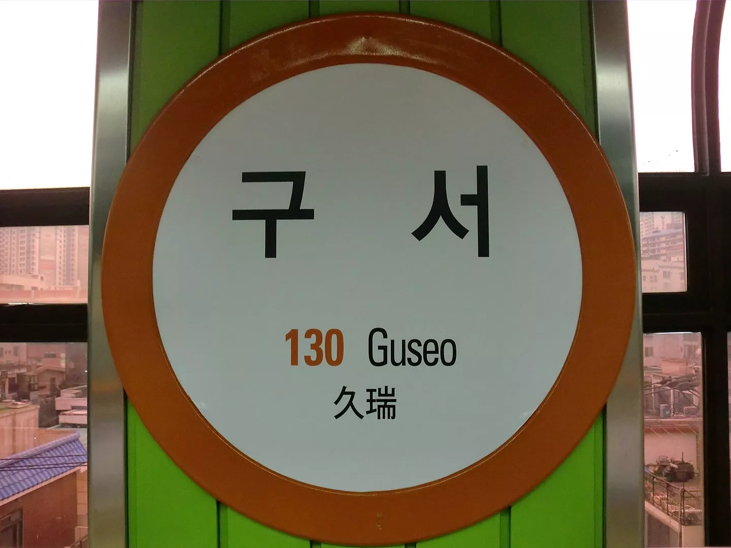
Guseo Station (Korean: 구서역) is a station of the Busan Metro Line 1 in Guseo-dong, Geumjeong District, Busan, South Korea. The Guseo Metro Station on Line 1 was opened on 19 July, 1985 and its code is 130. (Read More)
Choryang Station - 초량역
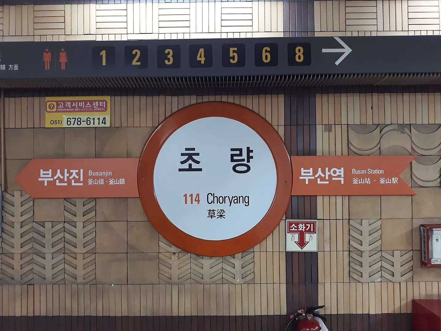
Choryang Station (Korean: 초량역; Hanja: 草梁驛) is a station of the Busan Metro Line 1 in Choryang-dong, Dong District, Busan, South Korea. The Choryang Metro Station was opened on 15 May, 1987 and its code is 114. (Read More)
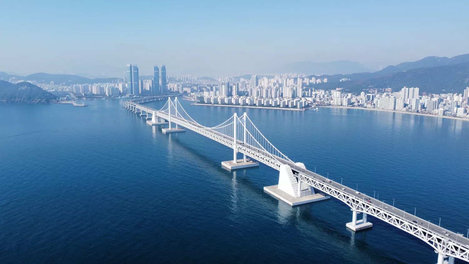
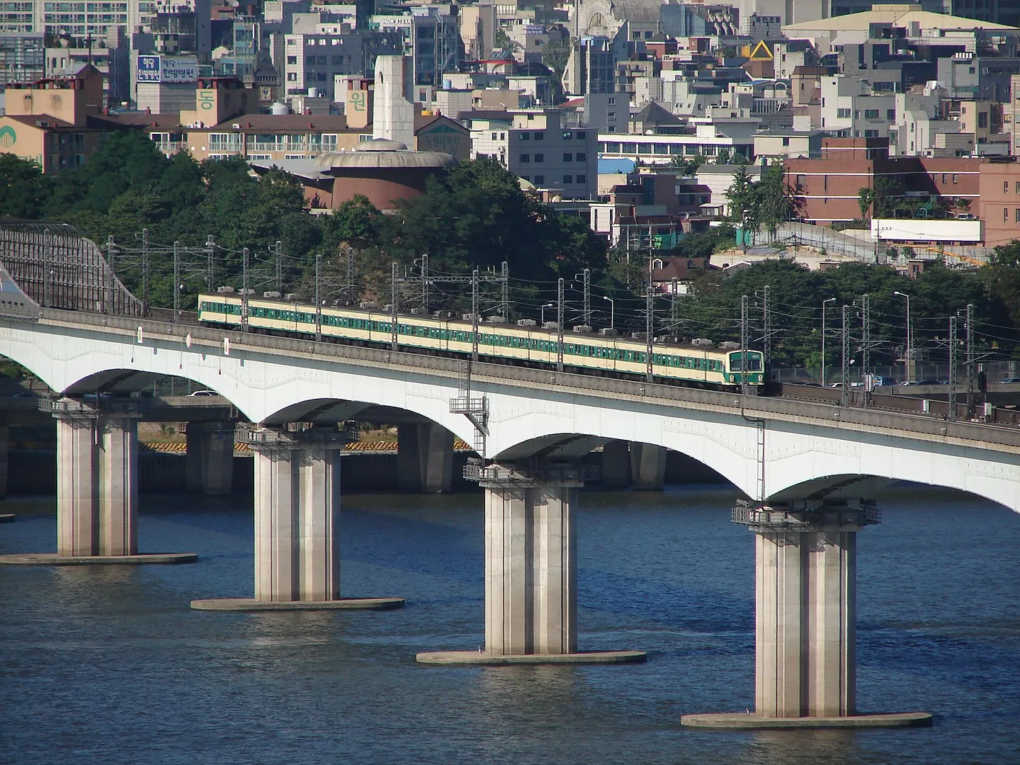
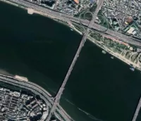
Cheongdam Bridge - 청담대교
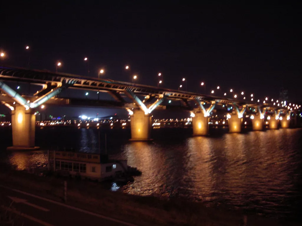
Cheongdam Bridge (Korean: 청담대교) is a bridge over the Han River in Seoul, South Korea. It is the 18th bridge to be constructed over the river. The bridge links the Gwangjin and Gangnam districts. It carries a section of Line 7 of the Seoul Subway, between Cheongdam Station and Ttukseom Resort Station, on its underside, making it the first 'duplex bridge' in South Korea. The road portion is a part of the Dongbu Expressway, which limits the bridge to motor traffic only. The (Read More)
Yongsan Station - 용산역
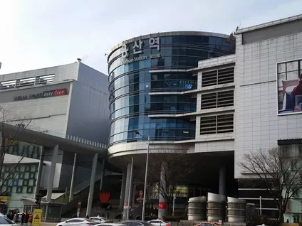
Yongsan station is a major railway station in Seoul, South Korea. It is located in Yongsan District, and adjoins the Yongsan Electronics Market. The station is the terminus for high-speed and long-distance trains on a number of railway lines, including most trains on the Honam Line, its high-speed counterpart, and all trains on the Janghang and Jeolla Lines. Yongsan station is also served by metro rail on Line 1 and the Gyeongui Jungang Line on the Seoul Metropolitan Subway. Yongsan Station has (Read More)
Pusan National University Station - 부산대역
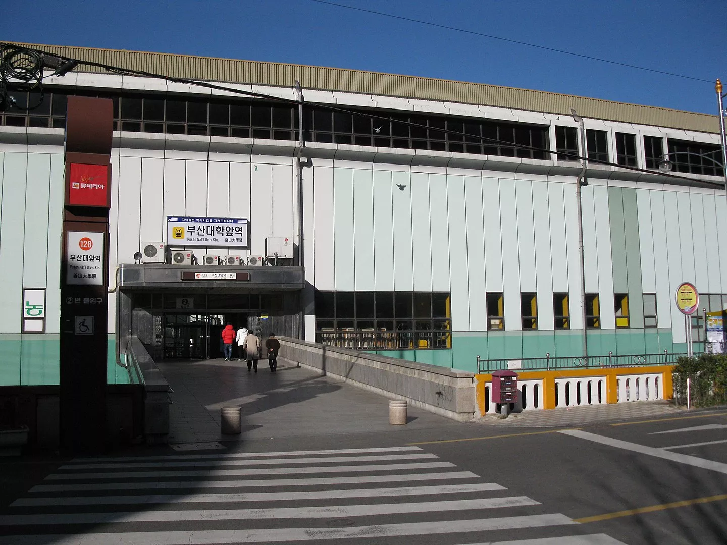
Pusan National University Station (Korean: 부산대역) is a station of Busan Metro Line 1 in Jangjeon-dong, Geumjeong District, Busan, South Korea. The Pusan National University Metro Station on Line 1 was opened on 19 July, 1985 and its code is 128. (Read More)
Yeonsan Station (Busan Metro) - 연산역
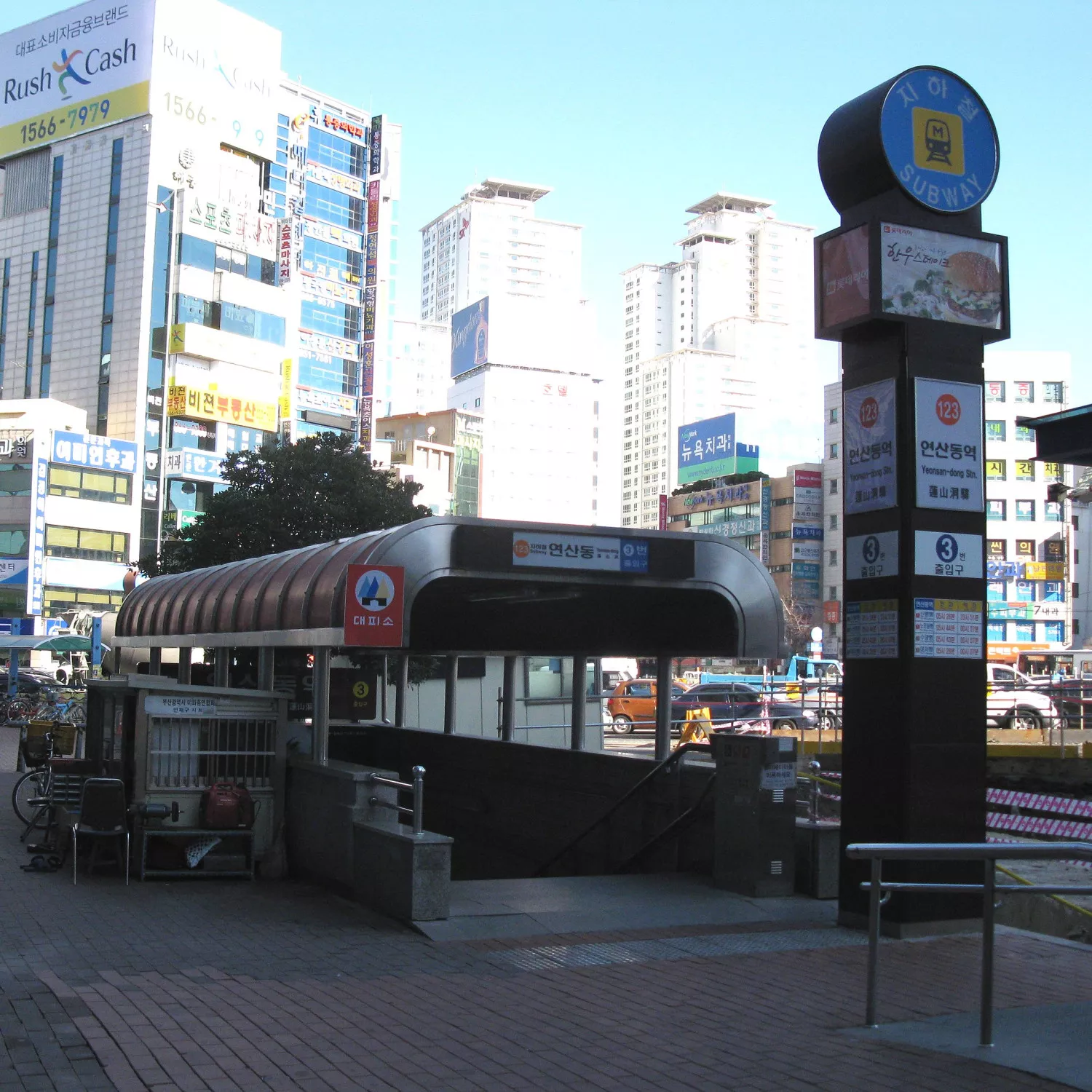
Yeonsan Station (Korean: 연산역) is a station of the Busan Metro Line 1 and Busan Metro Line 3 in Yeonsan-dong, Yeonje District, Busan, South Korea. The Yeonsan Metro Station on Line 1 was opened on 19 July, 1985 and its code is 123. The Yeonsan Metro Station on Line 3 was opened on November 28, 2005 and its code is 305. (Read More)
Seoul Express Bus Terminal

The Seoul Express Bus Terminal is the key bus terminal located in Seocho-gu, Seoul. It is connected underground to both the Gangnam branch of the Shinsaegae department store and the banpo underground market, as well as containing its own share of stores. As of September 2021, the third floor is abandoned spare a single sewing shop. (Read More)
Gangneung Train Station
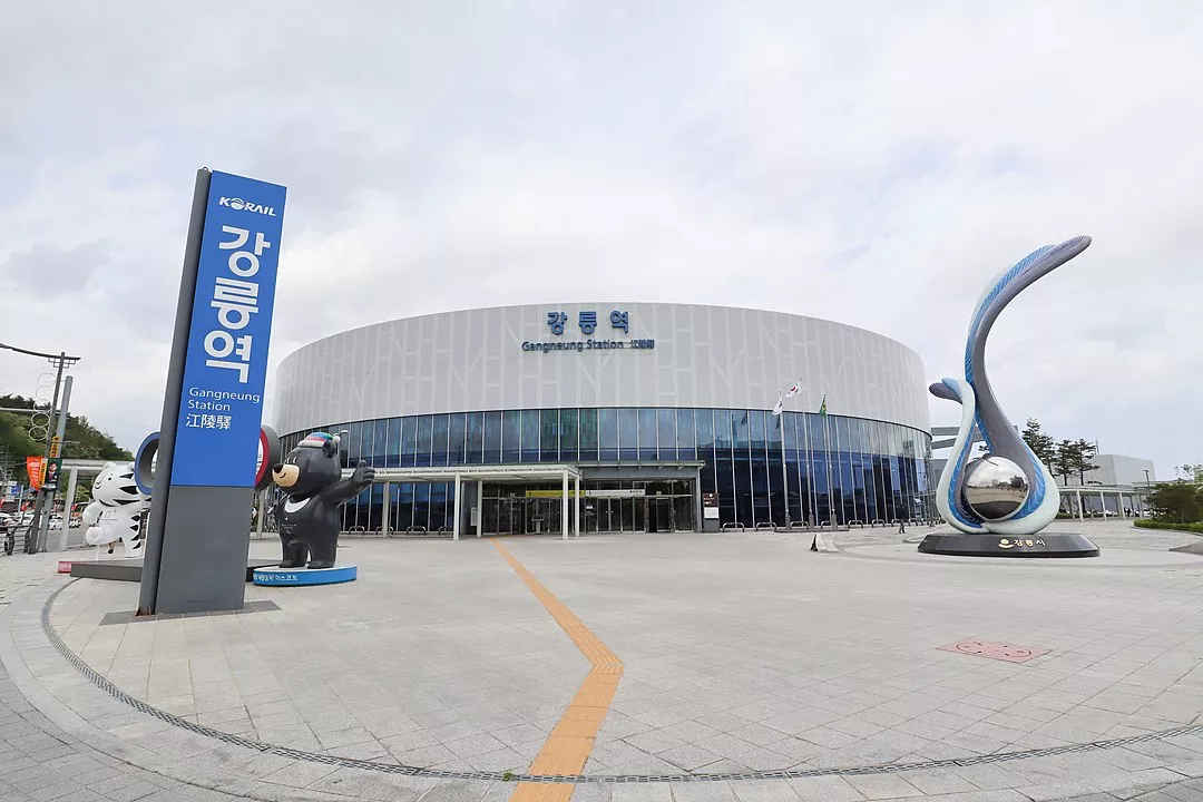
Gangneung Train Station (강릉역) is a railway station on the Yeongdong Line and Gangneung Line in Gangneung, Gangwon province, South Korea. It was originally open on November 6, 1962. The Gangneung Line and Gangneung station opened at December 22, 2017. The KTX-Sancheon (now KTX-Eum) trains started stopping here. However, the Mugunghwa-ho trains terminated at Jeongdongjin station before July 18, 2018, before all of the Mugunghwa trains that terminated at (Read More)
Beomnaegol station - 범내골역
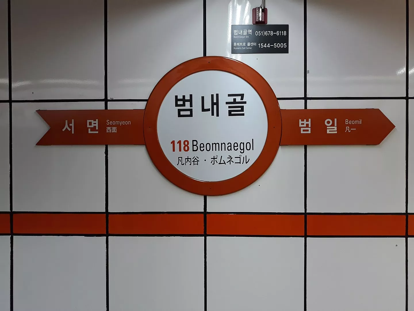
Beomnaegol Station (Korean: 범내골역) is a station of the Busan Metro Line 1 in Beomcheon-dong, Busanjin District, Busan, South Korea. The Jungang Metro Station was opened on 19 July, 1985 and its code is 118. (Read More)
Dangsan Railway Bridge - 당산철교
The Dangsan Railway Bridge (Korean: 당산철교) is a railway bridge that crosses the Han River in Seoul. It is used exclusively by Seoul Subway Line 2. Immediately on the south side of the bridge is Dangsan Station in Yeongdeungpo-gu, which is on an elevated platform. Hapjeong Station, a subterranean station in Mapo-gu, is located approximately 600 meters north of where the bridge makes landfall. After the partial collapse of Read More)
City Hall station (Busan Metro) - 시청역
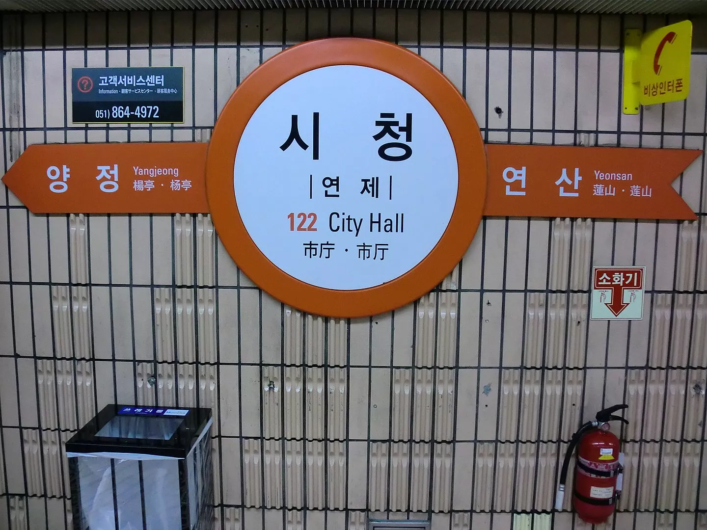
City Hall Station (Korean: 시청역) is a Busan Metro Line 1 station in Yeonsan-dong, Yeonje District, Busan, South Korea. The City Hall Metro Station was opened on 19 July, 1985 and its code is 122. A fire started at the station at 5:14 pm on July 16, 2014. No one died, but five people were injured and over 400 had to be evacuated. The fire was caused by an external power supply air conditioner. The line resumed normal operations by 6:55 pm the same day. (Read More)
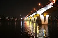
Banpo Bridge - 반포대교
The Banpo Bridge (Korean: 반포대교) is a major bridge in downtown Seoul over the Han River, South Korea, connecting the Seocho and Yongsan districts. The bridge is on top of Jamsu Bridge, forming the upper half of a double-deck bridge; it is the first double deck bridge built in South Korea. During periods of high rainfall, the Jamsu Bridge is designed to submerge as the water level of the river rises, as the lower deck lies close to the waterline. In the past decade, the bridge has (Read More)
Noryangjin Metro Station - 노량진역
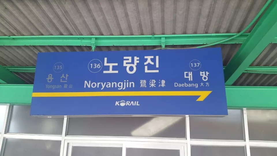
Noryangjin Station (ko:노량진역) is a metro station in central Seoul, South Korea. The station is located in the Noryangjin-dong (neighborhood) of Dongjak-gu (ward) and is also a stop on Seoul Subway Line 1 and Seoul Subway Line 9. This stop is a popular destination for those seeking to eat raw fish, and other assorted seafood, as a large, covered sea food market is located next to the station, accessible by foot bridge. The Line 1 station is also notable in that Exit 1 and 2 have the same number (Read More)
Yanghwa Bridge - 양화대교
The Yanghwa Bridge (양화대교) is an eight lane bridge spanning the Han River in Seoul. The bridge connects Mapo-gu on the north side of the river to Yeongdeungpo-gu on the south side of the river. The bridge is buttressed by the eastern end of the island of Seonyudo, home to Seonyudo Park (선유도공원). The bridge is a combination of two bridges: the old bridge, originally called the (Read More)
The Map of Infrastructures in South Korea
Navigate South Korea's infrastructures by keywords, dates, people, entities, and related questions adds depth and accessibility to understanding its evolution. Here's a concept:
Interactive Map Interface
Keyword Navigation: Users can input specific keywords to access relevant points on the map.
Date Slider: A slider allows users to explore infrastructural developments across different periods, from the post-war era to the present day.
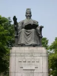
People & Entities: Clickable icons representing key figures or organizations involved in infrastructure development offer insights when selected. For example, selecting "Park Chung-hee" could reveal his contributions to South Korea's infrastructure modernization.
Question Search: A search bar invites users to ask questions ("Which was the first high-speed rail in South Korea?") for instant access to related map points or information.
Map's Objective:
The map serves as an evolving repository of South Korea's infrastructure history, encouraging engagement from experts, enthusiasts, and the general public. It aims to provide a comprehensive and interactive platform for learning, preserving, and celebrating the nation's infrastructural achievements while fostering a community-driven approach to knowledge sharing. Please do not hesitate to suggest a new point of interest for this topic.
 Loading data


.jpg)
.jpg)